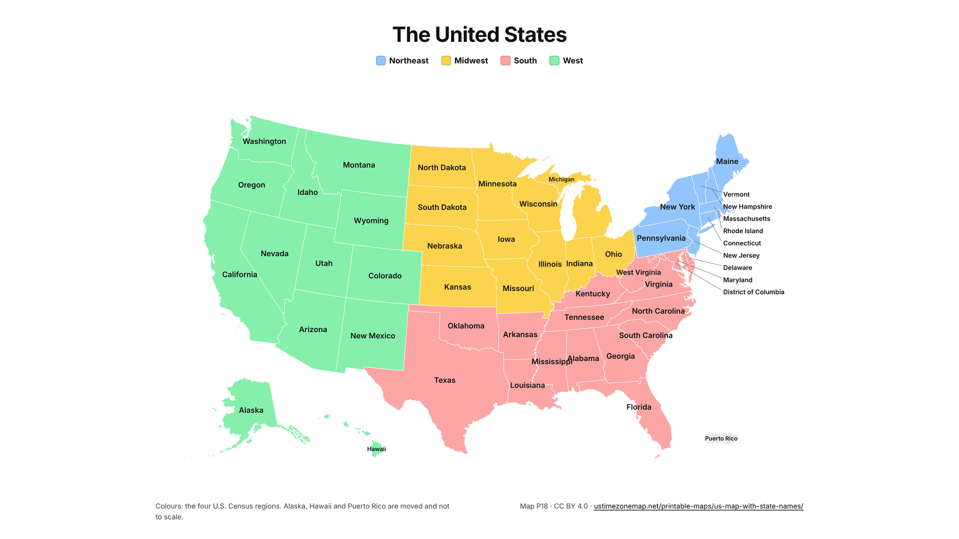
The United States
- Northeast
- Midwest
- South
- West
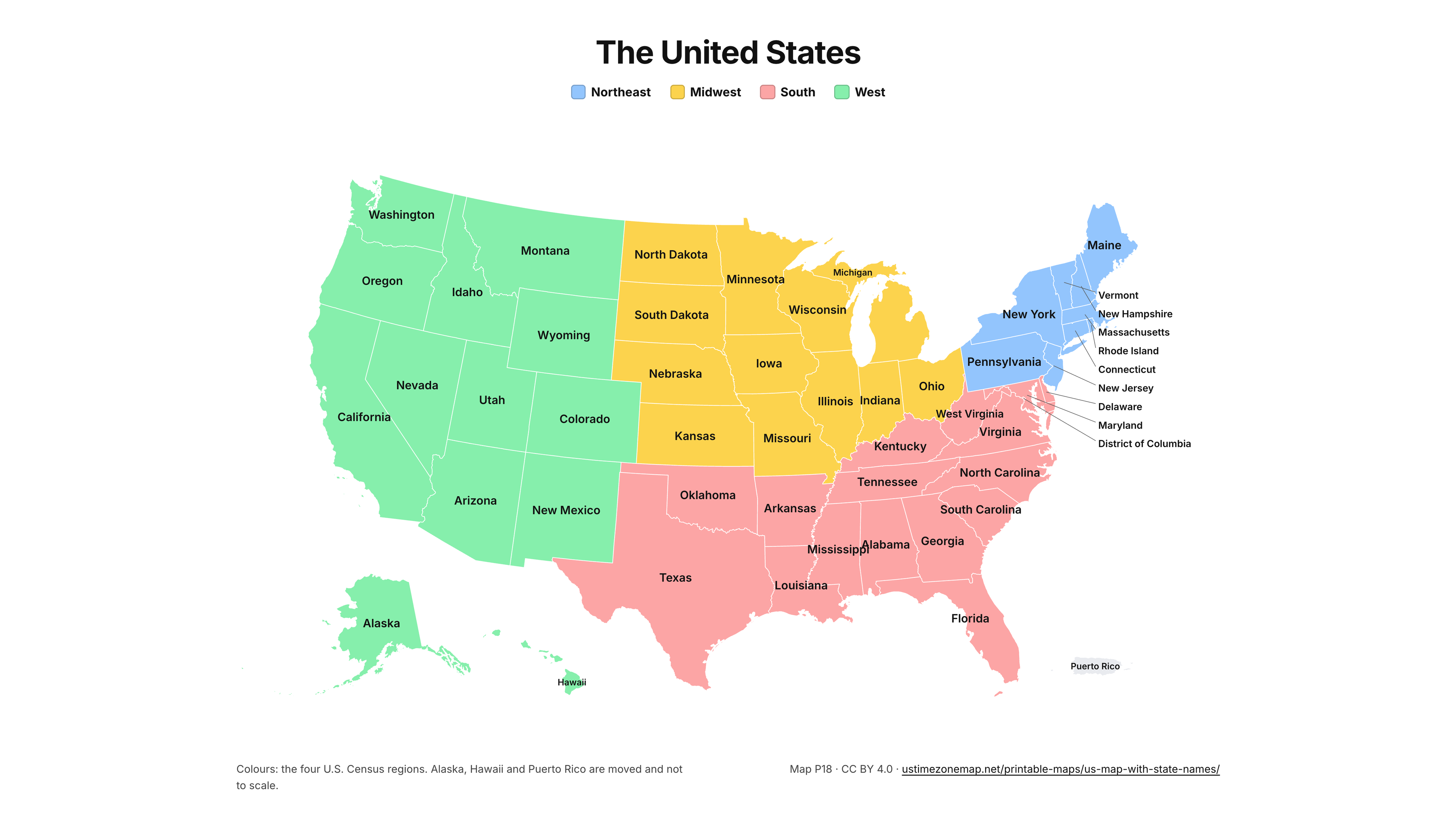
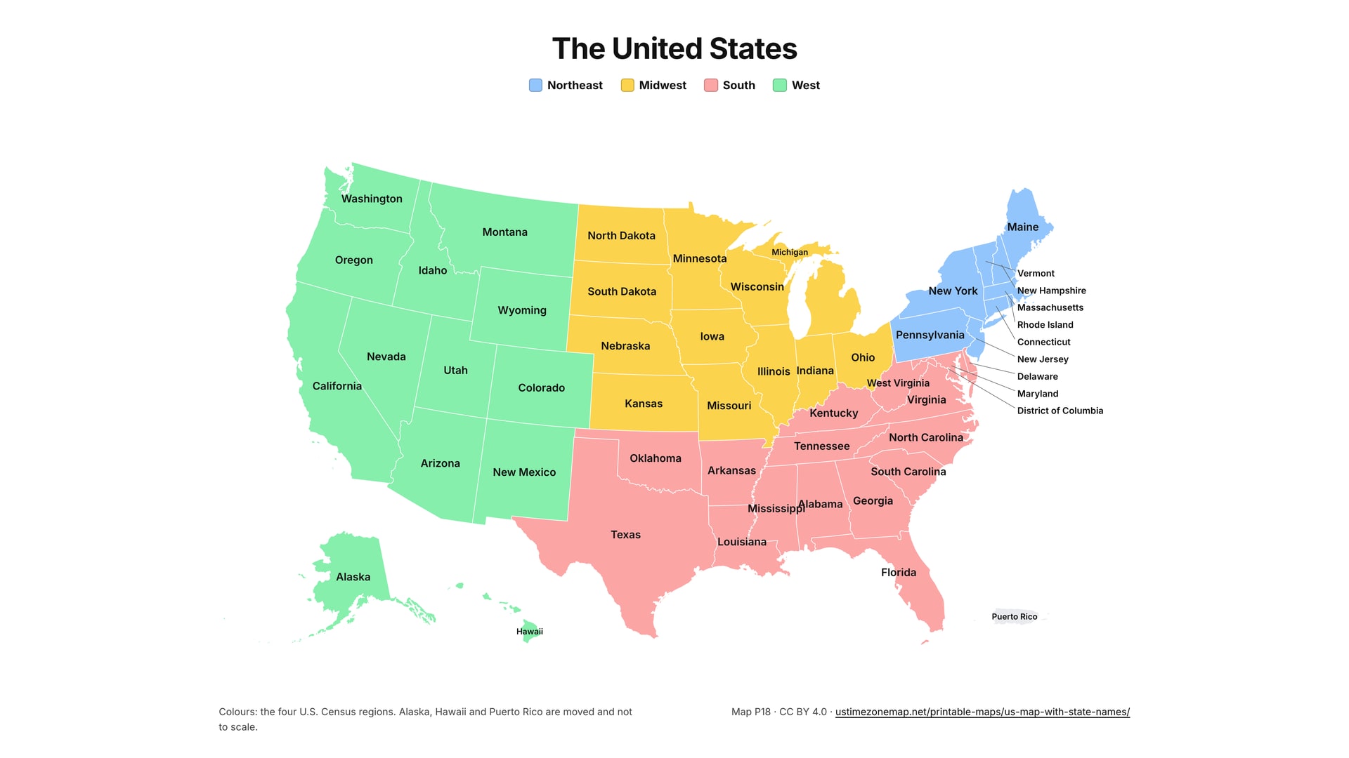
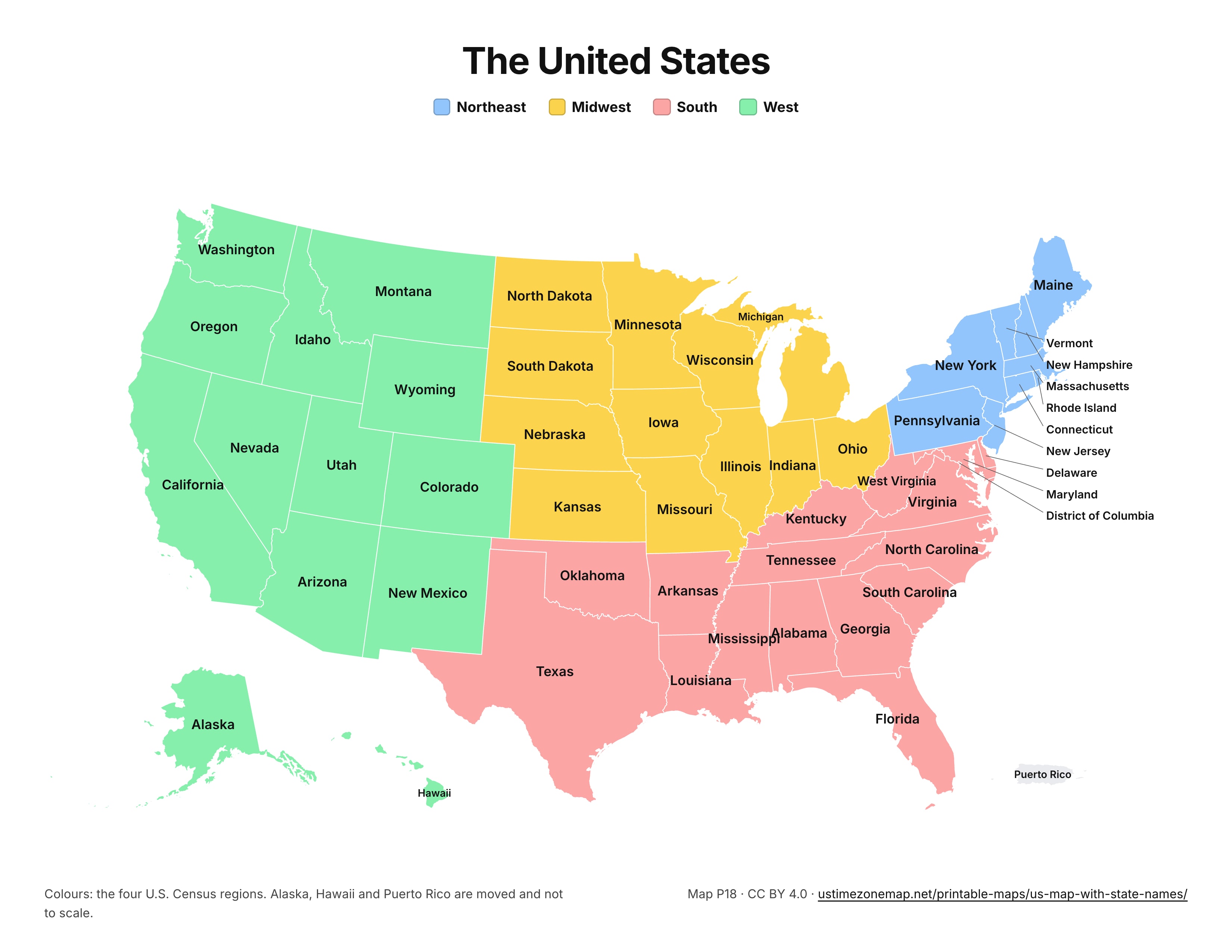
Every state named, coloured by the four Census regions (Northeast, Midwest, South, West), with Alaska, Hawaii and Puerto Rico in insets. The labelled map most people mean by a printable US map.
US Letter, landscape, one page, vector PDF: it stays sharp at any print size, poster printers included. Map code P18 sits in the corner so a class or team can refer to the same sheet. The link at the bottom right opens the live map, which shows the current time in every zone.
Test yourself on the same map with the 50 states quiz. Want it interactive instead? The interactive map of the US states turns names, capitals, cities and regions on and off, and the US map with cities lists every city by state.
Licensed under Creative Commons Attribution 4.0 (CC BY 4.0): print, copy, adapt and share it, in class or online, with credit to US Time Zone Map. Copy a citation or a credit link:
Press Print, or Ctrl + P (⌘ + P on a Mac). The sheet is set for US Letter in landscape and fills one page; on A4 choose “Fit to page”. Everything else on this page is left off the paper.
Yes. The sheet is licensed under Creative Commons Attribution 4.0 (CC BY 4.0): print, copy, adapt and share it, including in class materials and on websites, as long as you credit US Time Zone Map (ustimezonemap.net). The map is drawn from public-domain US Census boundaries.