US time zone map
Explore all six US time zones, state boundaries, and live city clocks on one interactive map.
Swipe to see all time zones
Printed Sat, Oct 31, 2026
Right now in the six zones
Hawaii to Maine, west to east, as the zones lie across the map. Each clock runs on its zone’s own rules, daylight saving included.
What each zone covers
The states and cities in each zone, and the exceptions spelled out.
Hawaii–Aleutian Time
UTC−10UTC−10 year-round, with no daylight saving. The furthest-behind zone in the United States; in summer it is six hours behind Eastern Time (five hours in winter). Hawaii opted out of daylight saving time under the Uniform Time Act of 1967.
Hawaii–Aleutian mapAlaska Time
UTC−9 / UTC−8One hour behind Pacific Time, for nearly all of Alaska — Anchorage, Fairbanks, and Juneau. Only the western Aleutian Islands use Hawaii–Aleutian Time. In 1983 most of Alaska, which had spanned four zones, was consolidated onto today’s Alaska Time.
Alaska mapPacific Time
UTC−8 / UTC−7The westernmost continental zone: California, Washington, nearly all of Nevada and Oregon, and the northern panhandle of Idaho. Nevada is Pacific except West Wendover, on the Utah line, which follows Mountain Time.
Pacific mapMountain Time
UTC−7 / UTC−6Colorado, Utah, New Mexico, Montana, Wyoming, and Arizona, plus southern Idaho and the western edges of Kansas, Nebraska, the Dakotas, and Texas. Arizona (except the Navajo Nation) stays on Mountain Standard Time year-round, so in summer it matches Pacific.
Mountain mapCentral Time
UTC−6 / UTC−5The hub zone: Illinois, Texas, Minnesota, and 17 more states in all or part. Ten states straddle its edges, from Texas and the Dakotas to Florida and Michigan. Nebraska is mostly Central, but its western Panhandle (Scottsbluff, Alliance, Sidney) is Mountain.
Central mapEastern Time
UTC−5 / UTC−4The densest zone: New York to Maine, plus most of the Mid-Atlantic and Southeast. Florida, Indiana, Kentucky, Michigan, and Tennessee each have parts on Central Time. Kentucky is the most famous split — the eastern half is Eastern, the western half is Central.
Eastern map
Fourteen states cross a line
Thirteen states are split along county lines, and Nevada’s West Wendover keeps Mountain Time. Point at a state to see it; open it for where the line runs.
- AlaskaAlaska Time; the western Aleutians are on Hawaii–Aleutian Time.
- FloridaEastern Time; the western Panhandle is Central.
- IdahoMountain Time; northern panhandle is Pacific.
- IndianaEastern Time; 12 counties near Chicago and Evansville are Central.
- KansasCentral Time; 4 western counties are Mountain.
- KentuckyEastern Time in the east; the western half is Central.
- MichiganEastern Time; 4 Upper Peninsula counties on the Wisconsin line are Central.
- NebraskaCentral Time; the western Panhandle is Mountain.
- NevadaPacific Time; West Wendover on the Utah line uses Mountain.
- North DakotaCentral Time; the southwest corner is Mountain.
- OregonPacific Time; most of Malheur County is Mountain.
- South DakotaCentral Time in the east; the western half is Mountain.
- TennesseeCentral Time; East Tennessee is Eastern.
- TexasCentral Time; El Paso and Hudspeth counties are Mountain.
How the clock got its zones
From sundials to the railroads to daylight saving: five dates behind every time on this map.
Before 1883
Sun time
Every town set its clocks by the sun overhead, so noon in Boston came about twelve minutes before noon in New York, and railroads juggled dozens of local times.

November 18, 1883
Railroad time
U.S. and Canadian railroads switched to standard zones an hour apart, set from Greenwich. Many towns reset their clocks the same day, remembered as “the day of two noons.”

1884
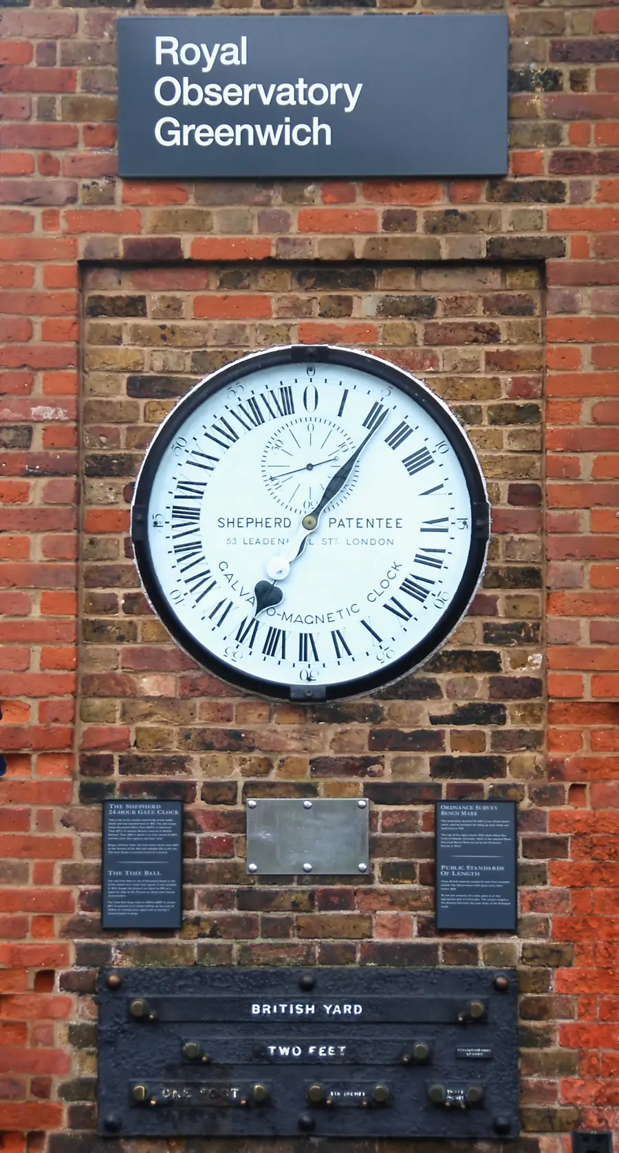
Greenwich
Delegates at the International Meridian Conference in Washington chose the Greenwich meridian as longitude zero — the line every UTC offset on this site is counted from.

1918 and 1966
Time by law
The Standard Time Act made the zones federal law in 1918. The Uniform Time Act of 1966 set common daylight-saving rules and let a state opt out, as Arizona and Hawaii do.

2026
Daylight saving
Since 2007 clocks spring forward on the second Sunday of March and fall back on the first Sunday of November: March 8 and November 1 this year.
Beyond the U.S.
The same map for the whole world, and for each continent, with the zones that matter there.
- WorldEvery zone shaded by its local hour, with 65 city clocks
- North AmericaThe U.S., Canada and Mexico, from UTC−10 to UTC−3:30
- CanadaSix zones, from Pacific to Newfoundland
- MexicoCentral Standard Time all year since 2022
- EuropeFrom the Azores at UTC−1 to Moscow at UTC+3
- AsiaIndia at +5:30, Nepal at +5:45, one clock for China
- AustraliaThree mainland zones, daylight saving in the south
- South AmericaFrom Colombia at UTC−5 to Brazil at UTC−3
Questions about U.S. time zones
How do I read the US time zone map?
Each colored band is one of the six U.S. zones; the faint outlines are state boundaries. Click a zone for its details, click a state to open its zone, or search a city to zoom to its live clock.
Where does the live time on the map come from?
Your device’s own IANA time zone database (the same source Google and Apple use). No server time is involved, so the map can’t be out of sync with your real clock and it’s accurate through daylight saving automatically.
Which states have more than one time zone?
Thirteen states officially span two zones: Alaska, Florida, Idaho, Indiana, Kansas, Kentucky, Michigan, Nebraska, North Dakota, Oregon, South Dakota, Tennessee, and Texas — plus Nevada, whose border city of West Wendover follows Mountain Time. The state pages show where each boundary runs.
Does this map show daylight saving time?
Yes. Because offsets are derived from the live zone database, a zone in daylight saving shows its summer offset automatically — no seasonal table to get stale.
Can I print the map?
The printable time zone map page uses a print stylesheet so the map, legend, and zone table come out clean on A4 or Letter, with no watermark.
How many time zones does the US have?
Six across the 50 states: Hawaii–Aleutian, Alaska, Pacific, Mountain, Central, and Eastern. U.S. territories add three more: Atlantic (Puerto Rico, U.S. Virgin Islands), Samoa (American Samoa), and Chamorro (Guam, Northern Mariana Islands).
What is the difference between EST and EDT?
EST (Eastern Standard Time) is UTC−5, used in winter. EDT (Eastern Daylight Time) is UTC−4, used in summer. The US shifts to EDT on the second Sunday in March and back on the first Sunday in November.
Which states have multiple time zones?
Thirteen: Alaska, Florida, Idaho, Indiana, Kansas, Kentucky, Michigan, Nebraska, North Dakota, Oregon, South Dakota, Tennessee, and Texas — plus Nevada, where the border city of West Wendover follows Mountain Time. The state pages show where each line runs.
Does all of Arizona observe daylight saving time?
No. Arizona stays on Mountain Standard Time year-round — with Hawaii, one of only two states that skip DST. The Navajo Nation in northeastern Arizona does observe Mountain Daylight Time, so in summer part of the state runs an hour ahead of Phoenix.
How do US time-zone boundaries work?
U.S. railroads introduced standard time zones in 1883 and Congress made them law in 1918. Today the U.S. Department of Transportation sets the boundaries, which mostly follow state and county lines; a county can petition to move zones, and states may opt out of daylight saving time but not choose their zone.
How can I find the time zone for a city?
Use the map’s search box — type a city or state and it zooms to it and shows the IANA zone and current time. Cities that share a name (Portland, Oregon and Portland, Maine) are listed with their state.
How do UTC offsets change during daylight saving time?
DST zones advance one hour. So Pacific goes UTC−8 → UTC−7, Mountain −7 → −6, Central −6 → −5, Eastern −5 → −4, Alaska −9 → −8. Hawaii and most of Arizona do not shift.